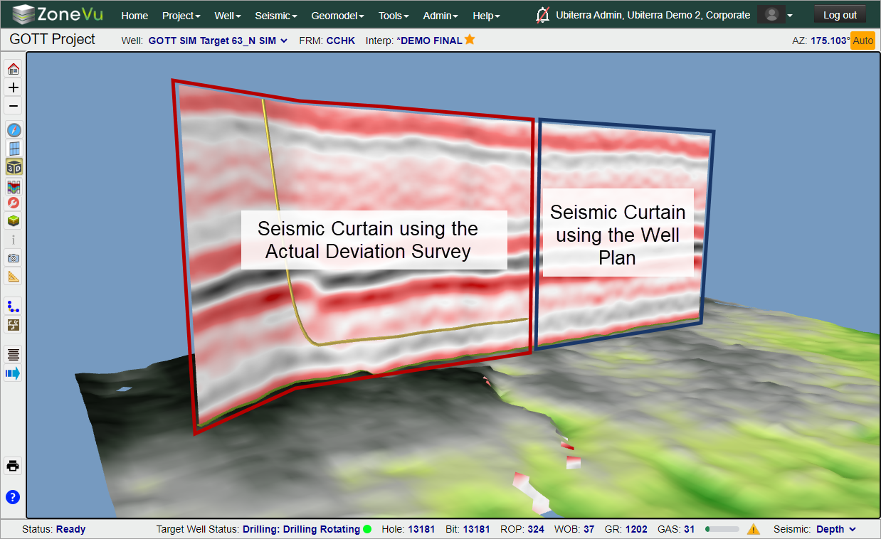
ZoneVu uses a Well's Plan and Actual Deviation Surveys to draw an arbitrary-line (arb-line). This arb-line is used to map the intersections between the actual Wellbore and three-dimensional objects such as Seismic, Faults Surfaces, Horizons, and Structural Surfaces. This article explains how ZoneVu uses this arb-line to create a Seismic Curtain used in the 3D & 2D Viewers.
When there are no Actual Survey Stations for a Well, ZoneVu will use the "Active" Well Plan to create an arb-line. This arb-line is used to sample the intersection points between the Well and the active Seismic Survey. These seismic samples are then stitched together, creating the Seismic Curtain. Once the Well begins drilling and ZoneVu starts receiving the Actual Survey Station, ZoneVu will update the arb-line with the actual Wellbore path. While the Well Plan is longer than the Well Path, ZoneVu will transition from the end of the Well path to the Well Plan when drawing the arb-line. Once the Well Path has exceeded the length of the Active Well Plan, ZoneVu will exclusively use the Well Path to draw the arb-line.
ZoneVu uses this method of seismic display to provide the most accurate display of seismic data. This method is also used to map out all Fault, Horizon, and Structural Surfaces displayed in the 2D Viewer.