

ZoneVu V6.7 is a workflow‑focused release designed to improve usability, data quality, and efficiency during active operations. This release includes the full rollout of RigStream 2.0, significant enhancements to LAS loading and bulk data imports, improved visualization of log curves along the active wellbore, and updates to Snapshots, Geosteering, Frac workflows, and navigation.
In addition to new functionality, V6.7 includes numerous stability, performance, and usability improvements across the platform. This article outlines the key updates included in the release, with links to supporting documentation where applicable.
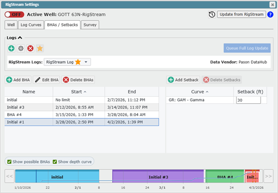
RigStream 2.0!
RigStream 2.0 introduces major improvements to simplify workflows, enhance data quality, and improve usability during active drilling operations:
RigStream GUI updates and simplification
Streamlined RigStream creation and BHA management workflows
Support for using a single log for all BHAs
Ability to create BHAs on a time scale
Expanded log curve support with bulk select and edit
All depth curves, including lag curves, are now supported
Survey QC warnings added and flagged in the updated Directional Survey tab
These changes are aimed at making RigStream easier to manage during active operations, while improving data quality and visibility.
Learn more:
Video: https://help.ubiterra.com/help/rigstream2-0video
Setup guide: https://help.ubiterra.com/help/settinguprigstream2-0
LAS Updates
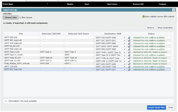
Multi-Well Bulk LAS Loading
Streamlined LAS Loading
New curves in LAS files are automatically detected and added
LAS files can be dropped onto Log folders in Scene Control
Streamlined data loading workflow in the Manual Drilling Dialog
These updates significantly reduce friction when refreshing or expanding log data across multiple wells.
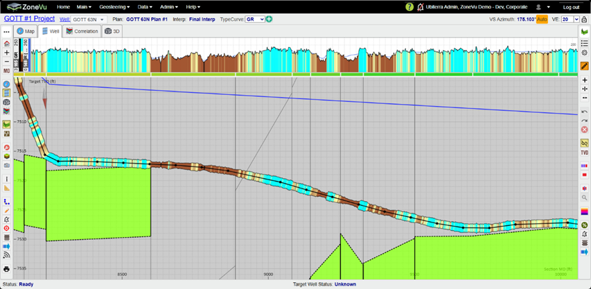
Log Curves Along the Active Well in the 2D Viewer!
Control which log is displayed via the Curve Settings dialog or Scene Control
Display curves on one or both sides of the wellbore
Customize color, diameter, and opacity
This provides greater flexibility when comparing and visualizing data directly along the active wellbore.
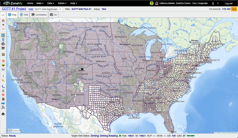
Texas Land Grid & Original Colony Boundaries
ZoneVu now includes more built‑in boundary datasets:
Texas Land Grid
Original Colony boundaries
These additions complete land boundary coverage across the Lower 48.
New Multi-File Drag and Drop loading dialog
New unified drag-and-drop import interface
Supports LAS, Bulk Well, and Top files in a single workflow
All import tools accessible from one dialog
This significantly simplifies bulk data loading and reduces repetitive import steps.
Scene Snapshot Updates
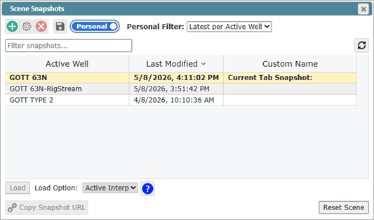
Snapshot GUI updated
Added “Last Modified By” column
Access to personal snapshots
Personal snapshots can now be saved indefinitely
Updated Snapshot load option labels
Added Multi‑tab snapshot support
These changes improve reliability, traceability, and collaboration.
Geosteering Updates
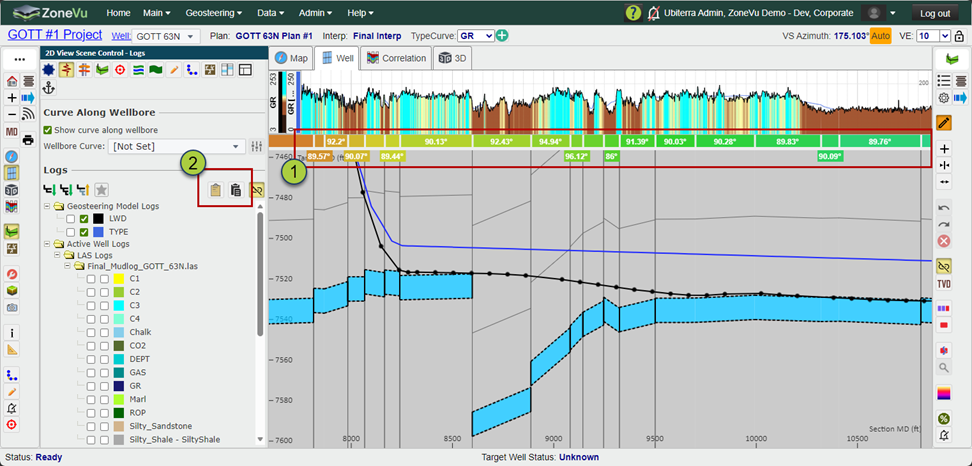
Block dip labels now appear in or near the Block Bar for improved visibility
Copy / Paste Geosteering Interpretation Display Settings added (Logs tab in Scene Control)
Updated UI icons for consistency
Intra‑block picks removed to simplify interpretation workflows
Added right-click ‘Delete Track’ option
New geosteering export options added:
At Survey Stations
At Survey Stations and Block Boundaries
These enhancements improve interpretation usability and setup, offer more Geosteering export options, and clean up some data display.
Measuring tool
Displays more data when multiple wells are selected
Improved selection snapping
Manual Drilling Dialog
New survey import options: Merge & Overwrite
Overwrite is now the default
Supports multi-step drag-and-drop imports
ZoneVu Frac
Frac LAS now contains all the curves
Added right-click option to delete plug
Update Import option now updates Stage geometry data
Correlation Panel updates
All user-defined frac curves are available
Improved control layout and usability
Automatically updates when new data is added
Improved log ordering and visual separation
Removed unsupported features
Updated master mnemonic list
Improved frac log naming clarity
Home Page Updates
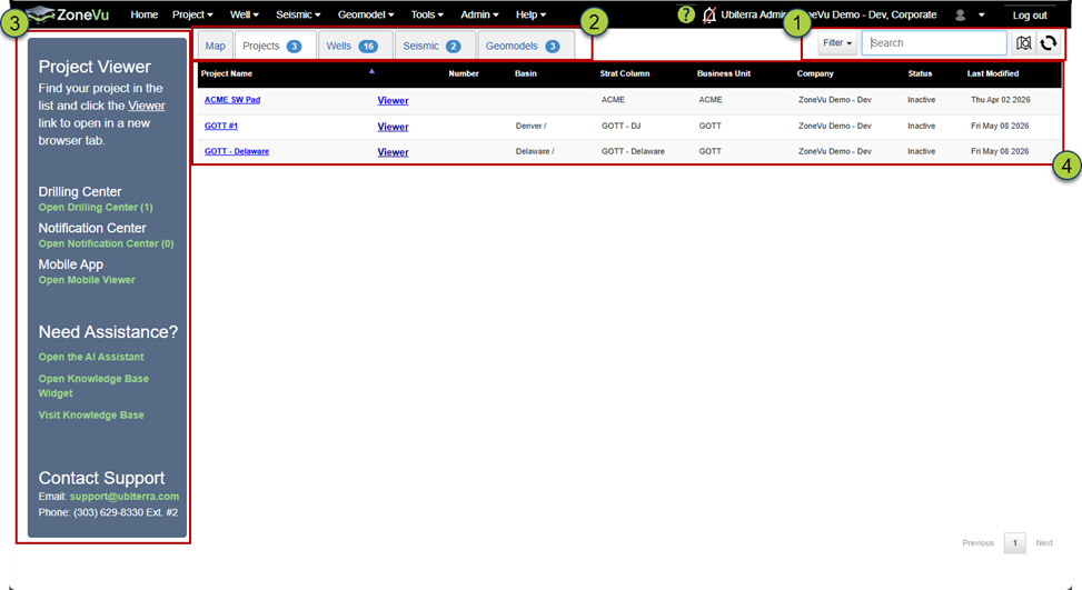
Unified search and filtering
Map and Data lists now honor the active filters
Updated left guidance menu for quicker access to key tools
New table columns added (e.g., Strat Column, Last Modified)
These updates improve navigation and performance, especially when working with large datasets.
Project Folder Updates
Updated data list UI
Improved Add/Remove data workflows
Updated Layer Files
Updated List UI
Auto-Save added to the edit dialog
Improved bulk feature editing
Directional Survey Tab Updated (Well Folder)
Updated UI
List is no longer paged
Data Source Colors Standardized
Added filtering
Added VS, SSTVD, and DLS columns
Plans can be renamed
Removed Calculate button
New RigStream tab added (Well Folder)
RigStream Settings present on the tab
RigStream Update list updated and improved
Added filtering to the Update list
Updates are now preserved for 15 days
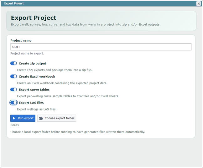
Project Data Export
You can now export core Well data into a ZIP file and/or Excel workbook, including:
Well headers
Surveys
Logs and curves
Top data
Note: Geosteering interpretations, frac data, seismic, and geomodel data are not included.
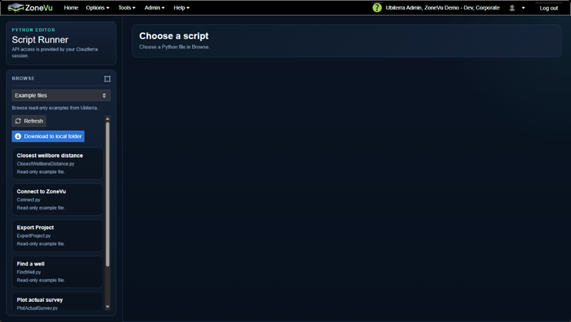
In‑Browser Python Environment
New browser-based Python environment connected to your ZoneVu account
Available under the Tools menu
Pre-populated with example scripts
This enables faster analysis, automation, and experimentation without leaving ZoneVu.
Python SDK Updates
New frac-related data columns added
Units of measure added to frac stage data
Additional Updates
Added new menu control icons
Added User Note Categories to Tools menu
Updated SSO setup and notification UI
Removed unused Target Line warning option
Improved log threshold fill labeling
Resolved Bugs
This release includes numerous bug fixes and stability improvements across the platform, including:
Empty Project error message updated
Bulk Well Import Spreadsheet ‘No integer’ loading error
Removed keyboard focus on hyperlinks
Jagged Plan display bug fixed
Mouse display grid values in a tool tip
API Key time to live issue
API Key access issue
Correlation Panel: Tops not automatically selected
Correlation Panel: Log Display requires a refresh
Correlation Panel: Duplicate Formation issue
Report Generator: Header Footer sizing issues resolved
Report Generator: Drop indication issues resolved
Report Generator: Page Scrolling issue resolved
Report Generator: Header height loading bug resolved
Report Generator: Multi-Header bug fixed
Scene Snapshot: Squished Map Loading issue resolved
ZoneVu Frac: Stage Numbering issue (Bug)
ZoneVu Frac: Frac 3D Viewer Selection issue (Bug)
ZoneVu Frac: Frac Design Gap (Bug)
ZoneVu Frac: User-defined Column multi-refresh issue (Bug)
ZoneVu Frac: Stage Length Recalculation issue (Bug)
ZoneVu Frac: Stage skipping/un-skipping issue (Bug)
ZoneVu Frac: User Defined Column Manager Units issue (Bug)